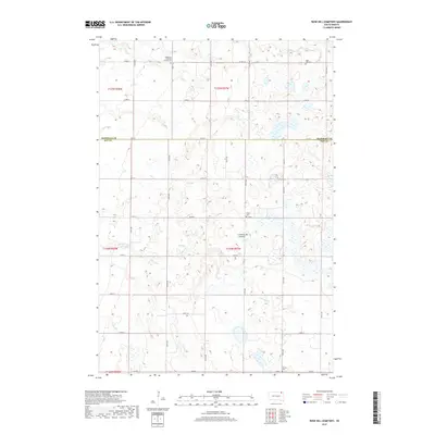
2017 Map of Rose Hill Cemetery
USGS Topo · Published 2017About this map
Coteau des Prairies forms the prominent geographical backbone of this region, shaping a landscape defined by an intricate network of wetlands and small glacial basins. This corner of the eastern Dakotas is characterized by a high concentration of small family and community burial sites, which speak to the area's rural settlement history. Notable landmarks include the Highlands Lutheran Church Cem and Rose Hill Cem, both positioned near the northern boundary, while Falnes Cem and Hanson Cem lie further south. The hydrography is dominated by the meandering Antelope Cr, which weaves between the countless unnamed prairie potholes that dot the township lines. A rectilinear grid of local roads, such as Co HWY 16 and Co RD 2, provides the primary framework for the scattered farmsteads and agricultural plots that comprise this rural landscape at the intersection of Marshall and Day Counties.
Find a feature on this map
25 named features on this map. Tap any name to fly to it.
Don’t see what you’re looking for? This feature index may not catch every label — zoom into the map to look around manually.
Map Details
Editions of this 2017 Rose Hill Cemetery Map
This is the sole edition of this map. No revisions or reprints were ever made.
Other maps of this area

1953 · Milbank
USGS Topo · 1:250,000

1958 · Milbank
USGS Topo · 1:250,000

1958 · Spain
USGS Topo · 1:24,000

1958 · Britton 4 NW
USGS Topo · 1:24,000

1958 · Britton 4 SW
USGS Topo · 1:24,000

1958 · Langford
USGS Topo · 1:24,000

1958 · Pierpont
USGS Topo · 1:24,000

1970 · Britton 4 NE
USGS Topo · 1:24,000

1970 · Britton 4 SE
USGS Topo · 1:24,000

1973 · Lynn Lake
USGS Topo · 1:24,000