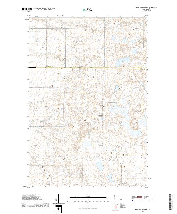
2021 Map of Rose Hill Cemetery
USGS Topo · Published 2021About this map
The Coteau des Prairies plateau defines this section of the South Dakota landscape along the border of Marshall and Day Counties. This area is characterized by a high concentration of small wetlands and prairie potholes that dot the township lines of t125n r57w and t124n r57w. The map is particularly useful for genealogical research, documenting several rural burial sites that anchor the agricultural community, including Falnes Cem, Hanson Cem, and Rose Hill Cem. To the northwest, the Highlands Lutheran Church Cem stands near the intersection of 122nd ST and 425th Ave. The drainage of Antelope Cr meanders through the central and southern portions of the quadrangle, weaving between the numerous unnamed water bodies that signify the unique glacial topography of the region.
Find a feature on this map
33 named features on this map. Tap any name to fly to it.
Don’t see what you’re looking for? This feature index may not catch every label — zoom into the map to look around manually.
Map Details
Editions of this 2021 Rose Hill Cemetery Map
This is the sole edition of this map. No revisions or reprints were ever made.
Other maps of this area

1953 · Milbank
USGS Topo · 1:250,000

1958 · Milbank
USGS Topo · 1:250,000

1958 · Spain
USGS Topo · 1:24,000

1958 · Britton 4 NW
USGS Topo · 1:24,000

1958 · Britton 4 SW
USGS Topo · 1:24,000

1958 · Langford
USGS Topo · 1:24,000

1958 · Pierpont
USGS Topo · 1:24,000

1970 · Britton 4 NE
USGS Topo · 1:24,000

1970 · Britton 4 SE
USGS Topo · 1:24,000

1973 · Lynn Lake
USGS Topo · 1:24,000