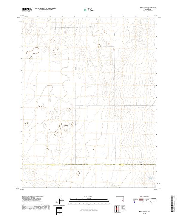
2022 Map of Rose Ranch
USGS Topo · Published 2022About this map
Kiowa County and Bent County meet along an expansive grid of rural roads in this high-plains landscape. The terrain is defined by subtle elevation changes and seasonal drainage patterns, with the most significant water source being Government Spring in the southeastern corner. This modern topographic study reveals a sparse, strictly organized landscape where land use is dictated by the Public Land Survey System, as seen in the prominent boundaries of t19s r50w and t20s r49w. A network of county routes, including Co Rd WW and Co Rd 31, connects the vast sections of this agricultural and ranching region.
Find a feature on this map
20 named features on this map. Tap any name to fly to it.
Don’t see what you’re looking for? This feature index may not catch every label — zoom into the map to look around manually.
Map Details
Editions of this 2022 Rose Ranch Map
This is the sole edition of this map. No revisions or reprints were ever made.
Other maps of this area

1891 · Las Animas
USGS Topo · 1:125,000

1892 · Lamar
USGS Topo · 1:125,000

1893 · Las Animas
USGS Topo · 1:125,000

1954 · Lamar
USGS Topo · 1:250,000

1955 · McClave
USGS Topo · 1:24,000

1955 · Tree Top Ranch
USGS Topo · 1:24,000

1955 · Lubers
USGS Topo · 1:24,000

1958 · Lamar
USGS Topo · 1:250,000

1968 · Rose Ranch
USGS Topo · 1:24,000
1968 · Swede Lake
USGS Topo · 1:24,000