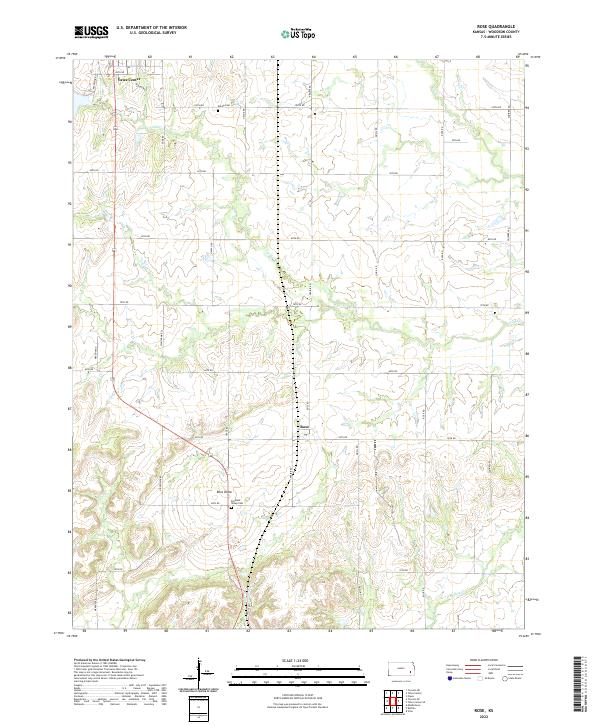
2022 Map of Rose
USGS Topo · Published 2022About this map
The southern outskirts of Yates Center transition into the agricultural heart of Woodson County in this contemporary landscape. The settlement of Rose sits at the intersection of Rose Rd and 50th Rd, serving as a central point for the surrounding farmsteads. To the southwest, the distinctive landform of Rose Dome marks the topography near Pleasant Valley Cem. The map reveals a grid of rural routes named for local wildlife and flora, such as Quail Rd, Squirrel Rd, and Mimosa Rd, which provide access to the drainage basins of S Owl Cr and Bloody Run. Genealogists will find interest in Kalida Cem in the northern portion of the quadrangle, which remains a key landmark in this section of the Kansas prairie.
Find a feature on this map
36 named features on this map. Tap any name to fly to it.
Don’t see what you’re looking for? This feature index may not catch every label — zoom into the map to look around manually.
Map Details
Editions of this 2022 Rose Map
This is the sole edition of this map. No revisions or reprints were ever made.
Other maps of this area

1886 · Fredonia
USGS Topo · 1:125,000

1894 · Fredonia
USGS Topo · 1:125,000

1938 · Fredonia
USGS Topo · 1:62,500

1938 · Altoona
USGS Topo · 1:62,500

1939 · Altoona
USGS Topo · 1:48,000

1939 · Fredonia
USGS Topo · 1:48,000

1942 · Fredonia
USGS Topo · 1:62,500

1943 · Fredonia
USGS Topo · 1:62,500

1943 · Altoona
USGS Topo · 1:62,500

1947 · Joplin
USGS Topo · 1:250,000