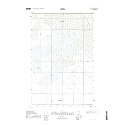
2019 Map of Roseau NE
USGS Topo · Published 2019About this map
The Roseau River meanders across a landscape defined by significant wetland areas and international proximity in northern Roseau County. This particular area is dominated by the Roseau Lakebed, a wide geographic depression that indicates the historical extent of glacial waters. Near the northern boundary with the United States of America, the topography rises slightly at Minnesota Hill, one of the few distinct elevation changes in this otherwise low-lying region. The map documents the grid of section roads that provide access to this rural borderland, including Co Rd 118, Co Rd 16, and various numbered avenues. This survey serves as a modern record of the drainage patterns and land use within the Red River of the North drainage basin, where the expansive lakebed area remains a central feature of the local environment.
Find a feature on this map
16 named features on this map. Tap any name to fly to it.
Don’t see what you’re looking for? This feature index may not catch every label — zoom into the map to look around manually.
Map Details
Editions of this 2019 Roseau NE Map
This is the sole edition of this map. No revisions or reprints were ever made.
Other maps of this area

1918 · Goos
USGS Topo · 1:62,500

1918 · Roseau
USGS Topo · 1:62,500

1943 · Goos
USGS Topo · 1:62,500

1954 · Roseau
USGS Topo · 1:250,000

1957 · Roseau
USGS Topo · 1:250,000

1958 · Roseau
USGS Topo · 1:250,000

1963 · Kenora
USGS Topo · 1:250,000
1966 · Pinecreek
USGS Topo · 1:24,000
1966 · Fox
USGS Topo · 1:24,000

1966 · Salol NW
USGS Topo · 1:24,000