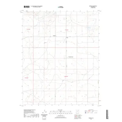
2020 Map of Rosebud
USGS Topo · Published 2020About this map
Rosebud and the adjacent Rosebud Farms anchor this portion of Harding County, New Mexico, in a landscape defined by ranching and rural aviation. The area's settlement history is preserved at the Rosebud Cemetery, which sits west of the community's center. Transportation in this high-plains environment relies on a network of unpaved corridors such as Rosebud Rd and Co Rd G, connecting local residents to the small Rosebud Airport. The topography is shaped by intermittent water sources like Hackberry Springs and the drainage of the Arroyo de la Cejita, which winds through the northwestern sections. To the east, Matis Lake provides a rare perennial water feature in an otherwise arid expanse of rangeland, illustrating the critical importance of water management for sustaining the local homesteads and agricultural operations documented here in the early twenty-first century.
Find a feature on this map
15 named features on this map. Tap any name to fly to it.
Don’t see what you’re looking for? This feature index may not catch every label — zoom into the map to look around manually.
Map Details
Editions of this 2020 Rosebud Map
This is the sole edition of this map. No revisions or reprints were ever made.
Other maps of this area

1954 · Tucumcari
USGS Topo · 1:250,000

1958 · Tucumcari
USGS Topo · 1:250,000

1966 · Rosebud
USGS Topo · 1:24,000

1966 · Ione
USGS Topo · 1:24,000

1966 · Hayden
USGS Topo · 1:24,000

1966 · Cherokee Valley
USGS Topo · 1:24,000

1966 · Cottonwood Springs
USGS Topo · 1:24,000

1966 · Mc Cloy Ranch
USGS Topo · 1:24,000

1969 · Gallegos NE
USGS Topo · 1:24,000

1973 · Bueyeros NE
USGS Topo · 1:24,000