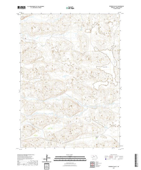
2021 Map of Rosebud Valley
USGS Topo · Published 2021About this map
Rosebud Valley defines the southern portion of this Nebraska landscape, where the N Loup River winds through a terrain marked by wide valleys and intermittent drainages. This modern survey illustrates the hydrology of Cherry County, from the northern flow of Gordon Cr and Betsy Cr to the wetlands surrounding Palmer Lake. The map details a transition from the elevated relief of Aljo Hill down to the expansive German Flats. Human impact is subtle but clear in the placement of W Dry Valley Rd, providing a look at the contemporary land divisions and rural infrastructure of the Sandhills region. The intricate contour work highlights the unique geomorphology of the area, revealing how Mud Cr and other small tributaries have shaped the local topography over time.
Find a feature on this map
13 named features on this map. Tap any name to fly to it.
Don’t see what you’re looking for? This feature index may not catch every label — zoom into the map to look around manually.
Map Details
Editions of this 2021 Rosebud Valley Map
This is the sole edition of this map. No revisions or reprints were ever made.
Other maps of this area

1949 · Big Falls
USGS Topo · 1:62,500

1950 · Powderhorn Valley
USGS Topo · 1:62,500

1950 · Doughboy
USGS Topo · 1:62,500

1950 · Wolf Lake
USGS Topo · 1:62,500

1951 · Big Falls
USGS Topo · 1:62,500

1951 · Wolf Lake
USGS Topo · 1:62,500

1952 · Doughboy
USGS Topo · 1:62,500

1957 · Valentine
USGS Topo · 1:250,000

1959 · Valentine
USGS Topo · 1:250,000

1985 · Powderhorn Valley SW
USGS Topo · 1:24,000