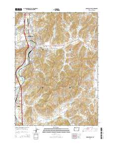
2014 Map of Roseburg East
USGS Topo · Published 2014About this map
The South Umpqua River defines the western corridor of this landscape, anchoring the city of Roseburg and the southern settlements of Oaks, Shady Point, and Green. This area is marked by a significant concentration of local heritage sites, including the Roseburg Masonic Cem, Roseburg IOOF Cem, and the Douglas County Cem. These sites, along with the Roseburg Catholic Cem, provide a rich resource for genealogists tracing the early residents of the Umpqua Valley.
Find a feature on this map
127 named features on this map. Tap any name to fly to it.
Don’t see what you’re looking for? This feature index may not catch every label — zoom into the map to look around manually.
Map Details
Editions of this 2014 Roseburg East Map
This is the sole edition of this map. No revisions or reprints were ever made.
Other maps of this area

1897 · Roseburg
USGS Topo · 1:125,000

1900 · Roseburg
USGS Topo · 1:125,000

1954 · Dixonville
USGS Topo · 1:62,500

1954 · Sutherlin
USGS Topo · 1:62,500

1954 · Glide
USGS Topo · 1:62,500

1955 · Roseburg
USGS Topo · 1:62,500

1958 · Roseburg
USGS Topo · 1:250,000

1959 · Roseburg
USGS Topo · 1:250,000

1979 · Roseburg
USGS Topo · 1:100,000
1987 · Roseburg East
USGS Topo · 1:24,000