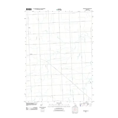
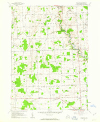
2011 Map of Roseburg
USGS Topo · Published 2011About this map
Roseburg sits at the intersection of Galbraith Line Rd and Bricker Rd, serving as a central point in this agricultural landscape of Sanilac County. The township's geography is defined by a complex drainage network, where Black Creek and Seymour Creek wind through a grid of section-line roads. Near the northern boundary, Fremont Cemetery provides a significant anchor for genealogical research, while Silver Trails Camp occupies a wooded stretch along the southern reaches of Silver Creek. The area maintains its rural character with a road system that preserves historical property boundaries, featuring prominent thoroughfares like Yale Rd and Jeddo Rd. Water management remains a primary feature of the landscape, evidenced by engineered waterways such as Eves Drain which support the local farming economy.
Find a feature on this map
36 named features on this map. Tap any name to fly to it.
Don’t see what you’re looking for? This feature index may not catch every label — zoom into the map to look around manually.
Map Details
Editions of this 2011 Roseburg Map
This is the sole edition of this map. No revisions or reprints were ever made.
Other maps of this area

1954 · Flint
USGS Topo · 1:250,000

1958 · Flint
USGS Topo · 1:250,000
1961 · Ruby
USGS Topo · 1:24,000

1961 · Roseburg
USGS Topo · 1:24,000
1961 · Avoca
USGS Topo · 1:24,000
1961 · Jeddo
USGS Topo · 1:24,000
1961 · Brockway
USGS Topo · 1:24,000

1961 · Yale
USGS Topo · 1:24,000

1963 · Peck
USGS Topo · 1:24,000

1963 · Croswell
USGS Topo · 1:24,000