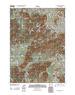
2011 Map of Roseburg West
USGS Topo · Published 2011About this map
The South Umpqua River snakes through this Douglas County landscape, serving as a primary geographic anchor for the communities of Roseburg, Winston, and Melrose. This 2011 survey captures the transition from the developed outskirts of Roseburg, including neighborhoods like Edenbower and Calkins, to the agricultural and timber-oriented lands to the west. Evidence of the region's industrial heritage is found at the Umpqua Log Pond near Green, while the rural character of the area is maintained through features like Napier Ranch and the small Lookingglass Airport. The map is particularly useful for genealogical research, identifying local burial sites such as Melrose Cemetery, Jones Family Cemetery, and Lookingglass Cemetery. Topography varies from the level ground of Lookingglass Valley to distinctive landmarks like Indian Nose and Lookingglass Hill, with numerous reservoirs such as Rieke Reservoir and Yoder Reservoir dotting the drainages of Stockel Creek and Lookingglass Creek.
Find a feature on this map
115 named features on this map. Tap any name to fly to it.
Don’t see what you’re looking for? This feature index may not catch every label — zoom into the map to look around manually.
Map Details
Editions of this 2011 Roseburg West Map
This is the sole edition of this map. No revisions or reprints were ever made.
Other maps of this area

1897 · Roseburg
USGS Topo · 1:125,000

1900 · Roseburg
USGS Topo · 1:125,000

1928 · Sitkum
USGS Topo · 1:125,000

1954 · Sutherlin
USGS Topo · 1:62,500

1955 · Camas Valley
USGS Topo · 1:62,500

1955 · Tyee
USGS Topo · 1:62,500

1955 · Roseburg
USGS Topo · 1:62,500

1958 · Roseburg
USGS Topo · 1:250,000

1959 · Roseburg
USGS Topo · 1:250,000

1979 · Roseburg
USGS Topo · 1:100,000