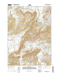
2014 Map of Roseburg West
USGS Topo · Published 2014About this map
The South Umpqua River defines the eastern and southern edges of this area, where the suburban growth of Roseburg meets the rural agricultural valleys of Douglas County. The landscape is marked by the distinct transition from the dense residential grids of Edenbower and Green to the sprawling hillsides near Lookingglass Hill. Local history and genealogy are preserved at the Melrose Cem, the Jones Family Cem, and the Lookingglass Cem. Small airfields like Napier Ranch Airport and George Felt Airport serve the region's aviators, while the Umpqua Log Pond near Little Valley reflects the enduring timber legacy of the Pacific Northwest. Between the winding path of Or 42 and the waters of Champagne Cr, the map records a modern settlement pattern of residential expansion and preserved open space within the Lookingglass Valley.
Find a feature on this map
59 named features on this map. Tap any name to fly to it.
Don’t see what you’re looking for? This feature index may not catch every label — zoom into the map to look around manually.
Map Details
Editions of this 2014 Roseburg West Map
This is the sole edition of this map. No revisions or reprints were ever made.
Other maps of this area

1897 · Roseburg
USGS Topo · 1:125,000

1900 · Roseburg
USGS Topo · 1:125,000

1928 · Sitkum
USGS Topo · 1:125,000

1954 · Sutherlin
USGS Topo · 1:62,500

1955 · Camas Valley
USGS Topo · 1:62,500

1955 · Tyee
USGS Topo · 1:62,500

1955 · Roseburg
USGS Topo · 1:62,500

1958 · Roseburg
USGS Topo · 1:250,000

1959 · Roseburg
USGS Topo · 1:250,000

1979 · Roseburg
USGS Topo · 1:100,000