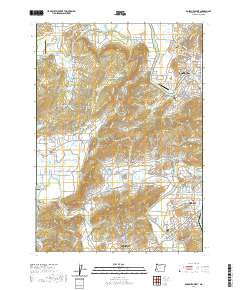
2020 Map of Roseburg West
USGS Topo · Published 2020About this map
The South Umpqua River snakes through the eastern half of this terrain, anchoring the growth of Roseburg and Winston. The river's path is marked by crossings like the Melrose Bridge and Winston Bridge, while the surrounding landscape transitions into the distinctive Lookingglass Valley and Champagne Creek Valley to the west. This 2020 survey shows the modern footprint of settlements like Edenbower, Calkins, and Green as they fill the spaces between the hills and the water. Local history is preserved in several small burial grounds, including the Jones Family Cem and Melrose Cem. The geography is defined by prominent rises such as Lookingglass Hill and Swan Hill, while numerous small water bodies like Lammys Reservoir and Hubbard Pond illustrate the intensive water management required for the region's agricultural and residential needs.
Find a feature on this map
161 named features on this map. Tap any name to fly to it.
Don’t see what you’re looking for? This feature index may not catch every label — zoom into the map to look around manually.
Map Details
Editions of this 2020 Roseburg West Map
This is the sole edition of this map. No revisions or reprints were ever made.
Other maps of this area

1897 · Roseburg
USGS Topo · 1:125,000

1900 · Roseburg
USGS Topo · 1:125,000

1928 · Sitkum
USGS Topo · 1:125,000

1954 · Sutherlin
USGS Topo · 1:62,500

1955 · Camas Valley
USGS Topo · 1:62,500

1955 · Tyee
USGS Topo · 1:62,500

1955 · Roseburg
USGS Topo · 1:62,500

1958 · Roseburg
USGS Topo · 1:250,000

1959 · Roseburg
USGS Topo · 1:250,000

1979 · Roseburg
USGS Topo · 1:100,000