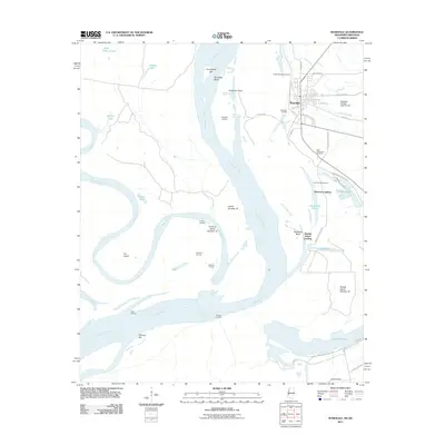
2011 Map of Rosedale
USGS Topo · Published 2011About this map
The Rosedale waterfront along the Mississippi River defines this region of Bolivar County, where the interaction between the shifting river channel and the massive Mississippi River Levee is meticulously documented. The map details a complex system of river management and historical navigation points, including several named river landings such as Riverton Landing, Klondike Landing, and Beulah Island Landing. These points, along with the Riverton Revetment, show the ongoing effort to stabilize the banks of the Rosedale Bend.
Find a feature on this map
50 named features on this map. Tap any name to fly to it.
Don’t see what you’re looking for? This feature index may not catch every label — zoom into the map to look around manually.
Map Details
Editions of this 2011 Rosedale Map
This is the sole edition of this map. No revisions or reprints were ever made.
Other maps of this area

1933 · Lamont
USGS Topo · 1:62,500

1939 · Pace
USGS Topo · 1:62,500

1939 · Big Island
USGS Topo · 1:62,500

1939 · Lamont
USGS Topo · 1:62,500

1939 · Choctaw
USGS Topo · 1:62,500

1953 · Greenwood
USGS Topo · 1:250,000

1956 · Greenwood
USGS Topo · 1:250,000

1967 · Lobdell
USGS Topo · 1:24,000
1969 · Choctaw
USGS Topo · 1:62,500
1969 · Beulah
USGS Topo · 1:24,000