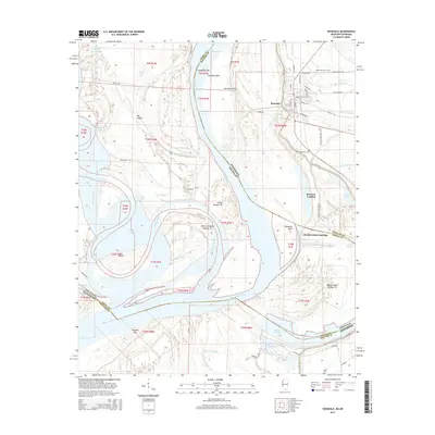
2015 Map of Rosedale
USGS Topo · Published 2015About this map
Rosedale sits at the heart of this landscape, positioned along the shifting curves of the Mississippi River where it meets the state line between Mississippi and Arkansas. This area is defined by the complex hydrography of the alluvial plain, featuring an intricate network of chutes, bayous, and oxbow lakes like Lake Beulah and Ozark Lake. The town's grid is clearly visible, with streets such as Martin Luther King Dr and Main St leading toward the riverbanks.
Find a feature on this map
70 named features on this map. Tap any name to fly to it.
Don’t see what you’re looking for? This feature index may not catch every label — zoom into the map to look around manually.
Map Details
Editions of this 2015 Rosedale Map
This is the sole edition of this map. No revisions or reprints were ever made.
Other maps of this area

1933 · Lamont
USGS Topo · 1:62,500

1939 · Pace
USGS Topo · 1:62,500

1939 · Big Island
USGS Topo · 1:62,500

1939 · Lamont
USGS Topo · 1:62,500

1939 · Choctaw
USGS Topo · 1:62,500

1953 · Greenwood
USGS Topo · 1:250,000

1956 · Greenwood
USGS Topo · 1:250,000

1967 · Lobdell
USGS Topo · 1:24,000
1969 · Choctaw
USGS Topo · 1:62,500
1969 · Beulah
USGS Topo · 1:24,000