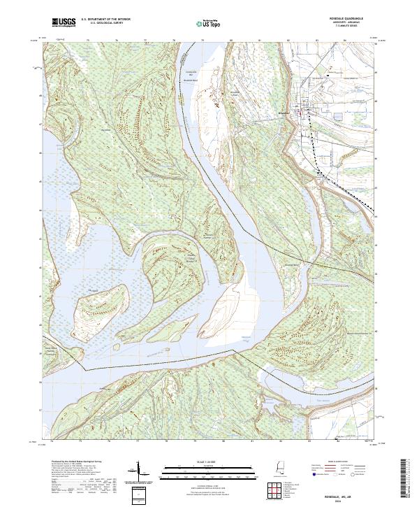
2024 Map of Rosedale
USGS Topo · Published 2024About this map
The Bolivar County Courthouse stands as a central landmark in Rosedale, Mississippi, where the complex hydrology of the Mississippi Delta is on full display. The Mississippi River and Arkansas River converge in a labyrinth of chutes, cutoffs, and oxbows, illustrating the restless nature of the state boundary. Significant river features like the Napoleon Cutoff and Rosedale Bend surround massive landforms such as Big Island and Cat Island.
Find a feature on this map
76 named features on this map. Tap any name to fly to it.
Don’t see what you’re looking for? This feature index may not catch every label — zoom into the map to look around manually.
Map Details
Editions of this 2024 Rosedale Map
This is the sole edition of this map. No revisions or reprints were ever made.
Other maps of this area

1933 · Lamont
USGS Topo · 1:62,500

1939 · Pace
USGS Topo · 1:62,500

1939 · Big Island
USGS Topo · 1:62,500

1939 · Lamont
USGS Topo · 1:62,500

1939 · Choctaw
USGS Topo · 1:62,500

1953 · Greenwood
USGS Topo · 1:250,000

1956 · Greenwood
USGS Topo · 1:250,000

1967 · Lobdell
USGS Topo · 1:24,000
1969 · Choctaw
USGS Topo · 1:62,500
1969 · Beulah
USGS Topo · 1:24,000