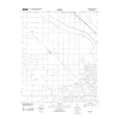
2012 Map of Rosedale
USGS Topo · Published 2012About this map
The agricultural and industrial character of the southern San Joaquin Valley is well-defined by the extensive network of irrigation and petroleum infrastructure in this Kern County landscape. The Calloway Canal and Friant-Kern Canal navigate the terrain, providing essential water to the surrounding fields and the Arkelo Ranch. This 2012 record captures a region where rail-side settlements like Cawelo, Lerdo, and Prospero align with the transportation corridor, while the Greeley Oil Field and Rosedale Oil Field illustrate the area's significant energy production legacy. Near the western edge of the quadrangle, Shafter Cem serves as a grounded point for genealogical research, situated amidst a grid of rural roads such as 7th Standard Rd and S Central Valley Hwy. Small crossroads like Hights Corner, Crome, and Una further delineate the local geography, showing the distribution of small-scale hubs across the productive valley floor.
Find a feature on this map
113 named features on this map. Tap any name to fly to it.
Don’t see what you’re looking for? This feature index may not catch every label — zoom into the map to look around manually.
Map Details
Editions of this 2012 Rosedale Map
This is the sole edition of this map. No revisions or reprints were ever made.
Other maps of this area

1906 · Bakersfield
USGS Topo · 1:62,500

1910 · Buena Vista Lake
USGS Topo · 1:125,000

1912 · Buena Vista Lake
USGS Topo · 1:125,000

1929 · Stevens
USGS Topo · 1:31,680

1929 · Coles Levee
USGS Topo · 1:31,680

1930 · Wasco
USGS Topo · 1:31,680

1930 · Famoso
USGS Topo · 1:31,680

1930 · Rosedale
USGS Topo · 1:31,680

1930 · Oildale
USGS Topo · 1:31,680

1931 · Rio Bravo
USGS Topo · 1:31,680