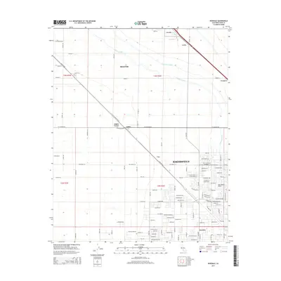
2015 Map of Rosedale
USGS Topo · Published 2015About this map
The San Joaquin Valley is defined here by a geometric grid of agriculture and infrastructure, where the expansion of Bakersfield meets established rural settlements. The landscape is dominated by essential water management systems, including the Friant-Kern Canal and the Calloway Canal, which sustain the region's productivity. Transport routes like Santa Fe Way and the railroad cut diagonally across the section lines, linking smaller communities such as Lerdo, Crome, and Una. This 2015 survey reveals the residential growth in Rosedale, where suburban street naming conventions like Grand Teton Dr and Mauna Loa Ave contrast with the older, straight-line ranch roads. To the northwest, Shafter maintains its distinct identity, centered near the Shafter Cem and reflecting the deep roots of the county's farming history.
Find a feature on this map
111 named features on this map. Tap any name to fly to it.
Don’t see what you’re looking for? This feature index may not catch every label — zoom into the map to look around manually.
Map Details
Editions of this 2015 Rosedale Map
This is the sole edition of this map. No revisions or reprints were ever made.
Other maps of this area

1906 · Bakersfield
USGS Topo · 1:62,500

1910 · Buena Vista Lake
USGS Topo · 1:125,000

1912 · Buena Vista Lake
USGS Topo · 1:125,000

1929 · Stevens
USGS Topo · 1:31,680

1929 · Coles Levee
USGS Topo · 1:31,680

1930 · Wasco
USGS Topo · 1:31,680

1930 · Famoso
USGS Topo · 1:31,680

1930 · Rosedale
USGS Topo · 1:31,680

1930 · Oildale
USGS Topo · 1:31,680

1931 · Rio Bravo
USGS Topo · 1:31,680