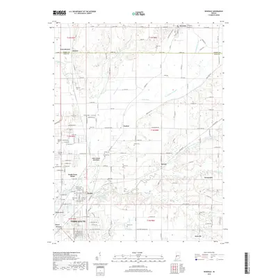
2019 Map of Rosedale
USGS Topo · Published 2019About this map
Otter Creek Junction sits as a central point in this landscape where Otter Creek and its various branches, including the North Branch Otter Creek, define the local drainage patterns. The transition from the rural northern edge of Terre Haute into the surrounding agricultural and industrial outskirts is marked by numerous small settlements and family-named cemeteries. To the north, Rosedale and the twin hamlets of Atherton and West Atherton bridge the border between Parke and Vigo counties. A dense network of local ditches like Swope Ditch and Gundy Ditch suggests a heavily managed water table, common in this part of Indiana to support both farming and suburban expansion. Other notable landmarks include the Sky King Airport and the sprawling Roselawn Memorial Park, which together with smaller burial sites like Kennedy Cem and Moses Cem, provide significant touchpoints for local genealogical research.
Find a feature on this map
160 named features on this map. Tap any name to fly to it.
Don’t see what you’re looking for? This feature index may not catch every label — zoom into the map to look around manually.
Map Details
Editions of this 2019 Rosedale Map
This is the sole edition of this map. No revisions or reprints were ever made.
Other maps of this area

1908 · Clay City
USGS Topo · 1:48,000

1910 · Clay City
USGS Topo · 1:62,500

1941 · Seelyville
USGS Topo · 1:24,000

1941 · Terre Haute
USGS Topo · 1:24,000

1948 · Terre Haute
USGS Topo · 1:24,000

1950 · Rosedale
USGS Topo · 1:24,000

1950 · Brazil West
USGS Topo · 1:24,000

1950 · New Goshen
USGS Topo · 1:24,000

1951 · Clinton
USGS Topo · 1:24,000

1951 · Mecca
USGS Topo · 1:24,000