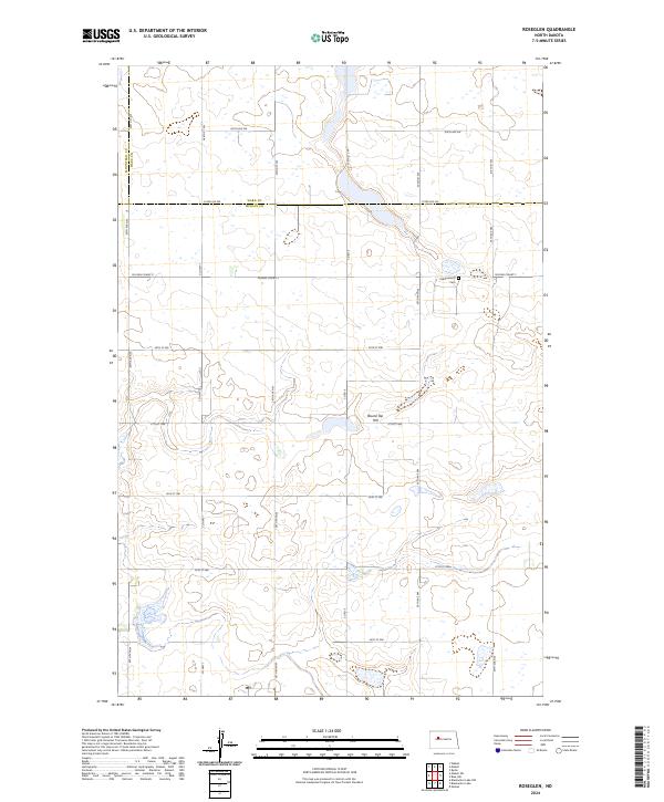
2024 Map of Roseglen
USGS Topo · Published 2024About this map
Hiddenwood National Wildlife Refuge anchors this northern Great Plains landscape, straddling the boundary where Ward and McLean counties meet. This contemporary survey shows a prairie environment defined by seasonal wetlands and potholes, vital for conservation efforts within the McLean County Waterfowl Production Area. The terrain is punctuated by significant local landmarks such as Round Top Hill, while the grid of section lines and gravel routes like Co Hwy 7 and Co Rd 9 organize the rural expanse. For those looking into local history, the Hiddenwood Cem remains a quiet marker of the settler families who first established homesteads in these townships. The map illustrates a modern state of land management where agriculture and wildlife preservation exist side-by-side along the Mountrail, Ward, and McLean county lines.
Find a feature on this map
31 named features on this map. Tap any name to fly to it.
Don’t see what you’re looking for? This feature index may not catch every label — zoom into the map to look around manually.
Map Details
Editions of this 2024 Roseglen Map
This is the sole edition of this map. No revisions or reprints were ever made.
Other maps of this area

1954 · McClusky
USGS Topo · 1:250,000

1956 · Makoti SW
USGS Topo · 1:24,000

1956 · Blackwater Lake NW
USGS Topo · 1:24,000

1956 · Blackwater Lake
USGS Topo · 1:24,000

1956 · Blue Hill
USGS Topo · 1:24,000

1956 · Emmet
USGS Topo · 1:24,000

1956 · Roseglen
USGS Topo · 1:24,000

1958 · McClusky
USGS Topo · 1:250,000

1980 · Makoti
USGS Topo · 1:24,000
1980 · Wabek
USGS Topo · 1:24,000