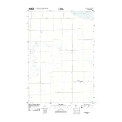
2010 Map of Rosen
USGS Topo · Published 2010About this map
The North Fork Yellow Bank River carves a winding path through this western Minnesota landscape, providing a natural contrast to the rigid grid of section roads that define the region. In the southeastern corner, the settlement of Rosen serves as a small rural hub, anchored by its proximity to Saint Joseph's Catholic Cemetery. The map is particularly useful for genealogical research, showing several burial grounds that mark the local heritage, including Saint Johns Cemetery in the north and Trinity Cemetery at the southern edge. The topography is largely even, though Big Tom Hill provides a distinct elevation point above the river valley. This survey documents the area just as the modern township road system, including routes like County Hwy-30 and 487th Ave, was firmly established to support the agricultural economy of Lac qui Parle County.
Find a feature on this map
23 named features on this map. Tap any name to fly to it.
Don’t see what you’re looking for? This feature index may not catch every label — zoom into the map to look around manually.
Map Details
Editions of this 2010 Rosen Map
This is the sole edition of this map. No revisions or reprints were ever made.
Other maps of this area

1953 · Ortonville
USGS Topo · 1:62,500

1953 · Bellingham
USGS Topo · 1:62,500

1953 · Milbank
USGS Topo · 1:250,000

1954 · Big Stone Lake
USGS Topo · 1:62,500

1958 · Milbank
USGS Topo · 1:250,000

1971 · Odessa
USGS Topo · 1:24,000

1971 · Marietta
USGS Topo · 1:24,000
1971 · Haydenville
USGS Topo · 1:24,000
1971 · Bellingham
USGS Topo · 1:24,000

1971 · Rosen
USGS Topo · 1:24,000