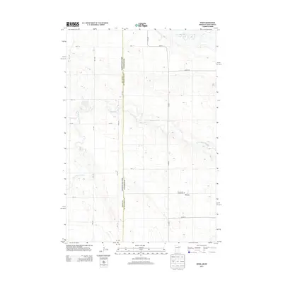
2013 Map of Rosen
USGS Topo · Published 2013About this map
Rosen sits at the eastern edge of this agricultural landscape, centered around a few key landmarks that define the community's local history. A primary focal point for genealogical research is Saint Joseph's Catholic Cem, located at the southern edge of the settlement near the junction of Co Hwy-7 and Co Hwy-30. The terrain is characterized by the meandering path of the N Fork Yellow Bank River, which winds across the border between South Dakota and Minnesota. This border, marked by the division of Grant and Lac Qui Parle counties, is traced by a series of section-line roads like 488th Ave. The map reflects a structured rural grid where county highways and named township roads, such as 148th St and 151st St, facilitate access to the isolated farmsteads and fields that dominate this borderland region.
Find a feature on this map
20 named features on this map. Tap any name to fly to it.
Don’t see what you’re looking for? This feature index may not catch every label — zoom into the map to look around manually.
Map Details
Editions of this 2013 Rosen Map
This is the sole edition of this map. No revisions or reprints were ever made.
Other maps of this area

1953 · Ortonville
USGS Topo · 1:62,500

1953 · Bellingham
USGS Topo · 1:62,500

1953 · Milbank
USGS Topo · 1:250,000

1954 · Big Stone Lake
USGS Topo · 1:62,500

1958 · Milbank
USGS Topo · 1:250,000

1971 · Odessa
USGS Topo · 1:24,000

1971 · Marietta
USGS Topo · 1:24,000
1971 · Haydenville
USGS Topo · 1:24,000
1971 · Bellingham
USGS Topo · 1:24,000

1971 · Rosen
USGS Topo · 1:24,000