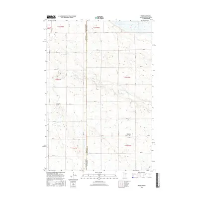
2016 Map of Rosen
USGS Topo · Published 2016About this map
The small community of Rosen serves as a focal point for this agrarian landscape along the border of South Dakota and Minnesota. Located in Lac qui Parle County, the area is defined by a grid of section lines and rural routes like Co Hwy 36 and Co Hwy 7, which connect isolated homesteads and family-held lands. The meandering course of the N Fork Yellow Bank River cuts through the terrain, providing a natural break in the otherwise structured township and range system.
Find a feature on this map
35 named features on this map. Tap any name to fly to it.
Don’t see what you’re looking for? This feature index may not catch every label — zoom into the map to look around manually.
Map Details
Editions of this 2016 Rosen Map
This is the sole edition of this map. No revisions or reprints were ever made.
Other maps of this area

1953 · Ortonville
USGS Topo · 1:62,500

1953 · Bellingham
USGS Topo · 1:62,500

1953 · Milbank
USGS Topo · 1:250,000

1954 · Big Stone Lake
USGS Topo · 1:62,500

1958 · Milbank
USGS Topo · 1:250,000

1971 · Odessa
USGS Topo · 1:24,000

1971 · Marietta
USGS Topo · 1:24,000
1971 · Haydenville
USGS Topo · 1:24,000
1971 · Bellingham
USGS Topo · 1:24,000

1971 · Rosen
USGS Topo · 1:24,000