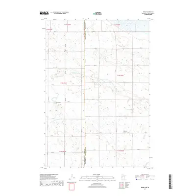
2019 Map of Rosen
USGS Topo · Published 2019About this map
The unincorporated community of Rosen sits near the southern edge of this West Central Minnesota landscape, defined by its proximity to the state line shared with South Dakota. The area is characterized by a high concentration of small wetlands and prairie potholes that dot the townships, creating a complex drainage pattern into the N Fork Yellow Bank River. Genealogists will find significant local history at Saint Joseph's Catholic Cem adjacent to the settlement and Saint Johns Cem further north. The terrain is largely level agricultural land, punctuated by modest elevations like Big Tom Hill, located just west of the Grant County and Lac qui Parle County boundary line.
Find a feature on this map
37 named features on this map. Tap any name to fly to it.
Don’t see what you’re looking for? This feature index may not catch every label — zoom into the map to look around manually.
Map Details
Editions of this 2019 Rosen Map
This is the sole edition of this map. No revisions or reprints were ever made.
Other maps of this area

1953 · Ortonville
USGS Topo · 1:62,500

1953 · Bellingham
USGS Topo · 1:62,500

1953 · Milbank
USGS Topo · 1:250,000

1954 · Big Stone Lake
USGS Topo · 1:62,500

1958 · Milbank
USGS Topo · 1:250,000

1971 · Odessa
USGS Topo · 1:24,000

1971 · Marietta
USGS Topo · 1:24,000
1971 · Haydenville
USGS Topo · 1:24,000
1971 · Bellingham
USGS Topo · 1:24,000

1971 · Rosen
USGS Topo · 1:24,000