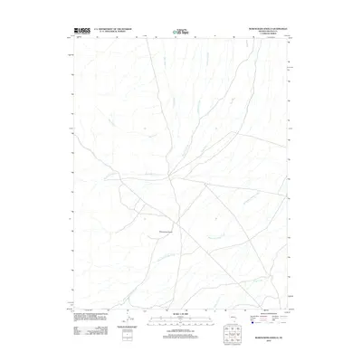
2012 Map of Rosencrans Knolls
USGS Topo · Published 2012About this map
Rosencrans Knolls stands as the central topographic landmark in this arid Lincoln County landscape, where water management is defined by a system of artificial and natural channels. The drainage pattern is marked by the presence of West Ditch and East Ditch, which parallel the natural course of Rosencrans Creek through the basin. These diversions suggest a history of agricultural or rangeland development in an environment where intermittent flows from Wood-McCullough Creek and Miller Creek are critical for sustaining the local territory. The map captures the delicate balance between the high desert terrain and the human engineering required to direct its seasonal waters.
Find a feature on this map
6 named features on this map. Tap any name to fly to it.
Don’t see what you’re looking for? This feature index may not catch every label — zoom into the map to look around manually.
Map Details
Editions of this 2012 Rosencrans Knolls Map
This is the sole edition of this map. No revisions or reprints were ever made.
Other maps of this area

1956 · Lund
USGS Topo · 1:250,000

1960 · Lund
USGS Topo · 1:250,000

1972 · Gleason Basin
USGS Topo · 1:24,000

1972 · Rosencrans Knolls
USGS Topo · 1:24,000

1972 · Hamlin Well
USGS Topo · 1:24,000

1972 · Miller Wash
USGS Topo · 1:24,000

1972 · Hyde Well
USGS Topo · 1:24,000

1972 · Miller Canyon
USGS Topo · 1:24,000

1973 · Atlanta
USGS Topo · 1:24,000
1973 · Trail Canyon
USGS Topo · 1:24,000