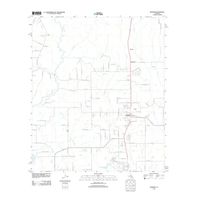
2012 Map of Rosepine
USGS Topo · Published 2012About this map
Rosepine serves as the central hub of this Vernon Parish landscape, situated along a north-south transit corridor that also connects the smaller settlements of Neame and Pinewood. The terrain is defined by an intricate drainage system including Flat Cr and Big Br, which feed toward Bayou Anacoco on the western edge of the quadrangle. For those researching local history, the map identifies several significant burial sites, including the centrally located Rosepine Cem, Cypress Creek Cem to the southwest, and Miller Cem in the northwest. A dense network of local roads such as Paul Midkiff Rd and Hinson Rd weaves through the countryside, illustrating the residential development and land use patterns of the early 21st century.
Find a feature on this map
112 named features on this map. Tap any name to fly to it.
Don’t see what you’re looking for? This feature index may not catch every label — zoom into the map to look around manually.
Map Details
Editions of this 2012 Rosepine Map
This is the sole edition of this map. No revisions or reprints were ever made.
Other maps of this area

1941 · Leesville
USGS Topo · 1:62,500

1941 · Slagle
USGS Topo · 1:62,500

1943 · Leesville
USGS Topo · 1:62,500

1944 · Slagle
USGS Topo · 1:62,500

1946 · Leesville
USGS Topo · 1:62,500

1947 · Pujo
USGS Topo · 1:31,680

1947 · DeRidder
USGS Topo · 1:31,680

1947 · Rosepine
USGS Topo · 1:31,680

1947 · Knight
USGS Topo · 1:31,680

1947 · Ikes
USGS Topo · 1:31,680