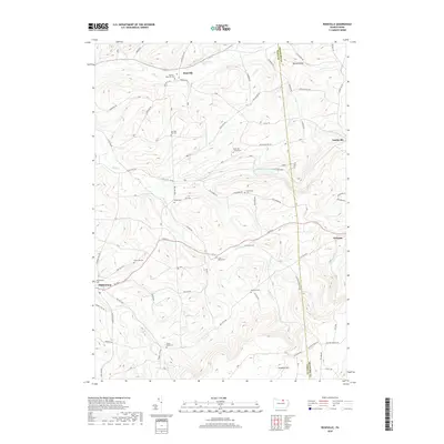
2019 Map of Roseville
USGS Topo · Published 2019About this map
Roseville and Mainesburg anchor this segment of the Northern Tier, where the high ridges of Armenia Mtn and Benson Knob overlook a landscape defined by narrow valleys and persistent family-named crossroads. The 2019 survey documents a deeply rooted rural geography where transportation still follows historical paths like US Rte 6 and Old State Rd. Numerous family and community burial grounds, including the Watson - Roseville Cem and Grey Valley Cem, are positioned along the slopes and valley floors, serving as vital landmarks for genealogists. The drainage patterns of Mill Cr and Elk Run have historically dictated the placement of settlements and farms, creating a network of small hamlets like Austinville and Sylvania that remain distinct centers of local identity within the broader Tioga and Bradford County borderlands.
Find a feature on this map
68 named features on this map. Tap any name to fly to it.
Don’t see what you’re looking for? This feature index may not catch every label — zoom into the map to look around manually.
Map Details
Editions of this 2019 Roseville Map
This is the sole edition of this map. No revisions or reprints were ever made.
Other maps of this area

1900 · Tioga
USGS Topo · 1:62,500

1902 · Tioga
USGS Topo · 1:62,500

1925 · Blossburg
USGS Topo · 1:62,500

1927 · Blossburg
USGS Topo · 1:62,500

1931 · Troy
USGS Topo · 1:48,000

1938 · Troy
USGS Topo · 1:62,500

1942 · Canton
USGS Topo · 1:62,500

1944 · Blossburg
USGS Topo · 1:62,500

1944 · Canton
USGS Topo · 1:62,500

1953 · Roseville
USGS Topo · 1:24,000