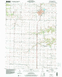
1998 Map of Roseville
USGS Topo · Published 2000About this map
The village of Roseville serves as the primary hub of this west-central Illinois landscape, where the prairie grid of Ellison and Point Pleasant townships meets a complex drainage network. The terrain is defined by the headwaters of several significant waterways, including Ellison Creek and the meandering Big Negro Creek, which carve distinct valleys through the agricultural uplands. Evidence of late 20th-century civic life is visible in the distribution of rural landmarks, from the Townhall in Point Pleasant to the High School and Memorial Park Cemetery in Roseville.
Find a feature on this map
26 named features on this map. Tap any name to fly to it.
Don’t see what you’re looking for? This feature index may not catch every label — zoom into the map to look around manually.
Map Details
Editions of this 1998 Roseville Map
This is the sole edition of this map. No revisions or reprints were ever made.
Other maps of this area

1916 · Good Hope
USGS Topo · 1:62,500

1918 · La Harpe
USGS Topo · 1:62,500

1918 · Good Hope
USGS Topo · 1:62,500

1921 · Monmouth
USGS Topo · 1:62,500

1923 · Monmouth
USGS Topo · 1:62,500

1934 · Oquawka
USGS Topo · 1:48,000

1940 · Oquawka
USGS Topo · 1:62,500

1958 · Burlington
USGS Topo · 1:250,000

1961 · Burlington
USGS Topo · 1:250,000

1963 · Burlington
USGS Topo · 1:250,000