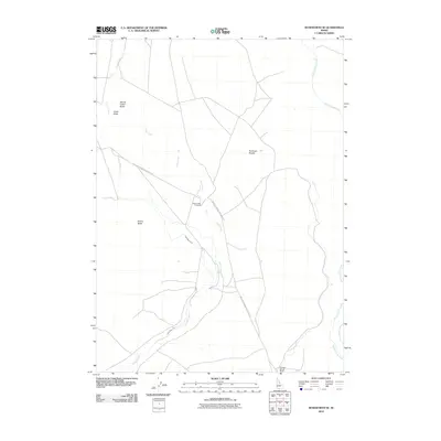
2010 Map of Roseworth SE
USGS Topo · Published 2010About this map
Salmon Falls Creek and the meandering Cedar Creek define this high plateau landscape, illustrating the critical role of water management in Idaho's agricultural history. The intricate path of the Cedar Mesa Canal weaves through the terrain, supporting local ranching operations like the Antelope Spring Ranch. This 2010 survey highlights the intersection of natural features and human adaptation, marked by distinctive landforms such as Emery Butte and the curiously named Secret Cabin Butte. Transportation through this open country is anchored by the Antelope Spring Roseworth Rd, which provides access to remote locations including Antelope Pocket. Geologists and local historians can trace the specific drainage patterns of Cedar Draw and locate the historic point at Cedar Creek Crossing, providing a clear record of the area's rural infrastructure at the start of the decade.
Find a feature on this map
10 named features on this map. Tap any name to fly to it.
Don’t see what you’re looking for? This feature index may not catch every label — zoom into the map to look around manually.
Map Details
Editions of this 2010 Roseworth SE Map
This is the sole edition of this map. No revisions or reprints were ever made.
Other maps of this area

1955 · Twin Falls
USGS Topo · 1:250,000

1958 · Twin Falls
USGS Topo · 1:250,000

1964 · Roseworth
USGS Topo · 1:24,000

1965 · Hollister SW
USGS Topo · 1:24,000

1965 · Roseworth SE
USGS Topo · 1:24,000

1965 · Roseworth NE
USGS Topo · 1:24,000

1965 · Berger Butte
USGS Topo · 1:24,000

1965 · Tuanna Butte
USGS Topo · 1:24,000

1977 · Cedar Creek Reservoir
USGS Topo · 1:24,000

1977 · Salmon Butte
USGS Topo · 1:24,000