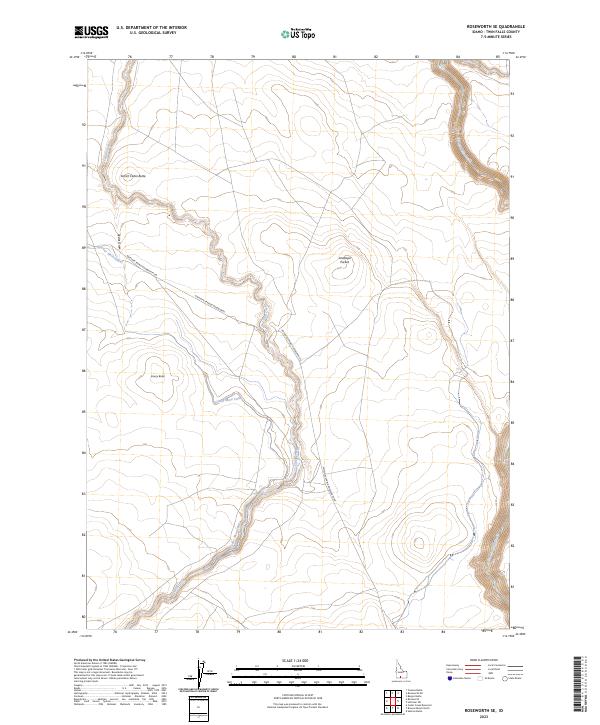
2023 Map of Roseworth SE
USGS Topo · Published 2023About this map
Secret Cabin Butte and Emery Butte rise above a landscape defined by an intricate network of irrigation and water management in this Twin Falls County survey. The presence of the Cedar Mesa Canal and Cedar Draw reflects the critical importance of water engineering in high-desert agriculture, where seasonal flows are harnessed for the land. Natural watercourses like Cedar Creek and the steep-sided canyon of Salmon Falls Creek slice through the terrain, creating distinct geographic boundaries and elevation changes. The sparse road network, centered on Antelope Spring Roseworth Rd, connects these isolated water features and landmarks like Antelope Pocket, illustrating the vast, open character of southern Idaho's rangeland and its reliance on specific transit corridors for movement between remote buttes and drainages.
Find a feature on this map
14 named features on this map. Tap any name to fly to it.
Don’t see what you’re looking for? This feature index may not catch every label — zoom into the map to look around manually.
Map Details
Editions of this 2023 Roseworth SE Map
This is the sole edition of this map. No revisions or reprints were ever made.
Other maps of this area

1955 · Twin Falls
USGS Topo · 1:250,000

1958 · Twin Falls
USGS Topo · 1:250,000

1964 · Roseworth
USGS Topo · 1:24,000

1965 · Hollister SW
USGS Topo · 1:24,000

1965 · Roseworth SE
USGS Topo · 1:24,000

1965 · Roseworth NE
USGS Topo · 1:24,000

1965 · Berger Butte
USGS Topo · 1:24,000

1965 · Tuanna Butte
USGS Topo · 1:24,000

1977 · Cedar Creek Reservoir
USGS Topo · 1:24,000

1977 · Salmon Butte
USGS Topo · 1:24,000