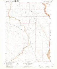
1979 Map of Roseworth SE
USGS Topo · Published 1980About this map
Salmon Falls Creek and Cedar Creek dominate this high-desert landscape in southern Idaho, where water management infrastructure defines the human imprint on the land. The presence of a significant Aqueduct and a Canal system, alongside several strategically placed Water Tanks, reveals the logistical efforts to support ranching or agriculture in the arid terrain between Cedar Mesa and the plateau simply labeled Pocket.
Find a feature on this map
16 named features on this map. Tap any name to fly to it.
Don’t see what you’re looking for? This feature index may not catch every label — zoom into the map to look around manually.
Map Details
Editions of this 1979 Roseworth SE Map
This is the sole edition of this map. No revisions or reprints were ever made.
Other maps of this area

1955 · Twin Falls
USGS Topo · 1:250,000

1958 · Twin Falls
USGS Topo · 1:250,000

1964 · Roseworth
USGS Topo · 1:24,000

1965 · Hollister SW
USGS Topo · 1:24,000

1965 · Roseworth SE
USGS Topo · 1:24,000

1965 · Roseworth NE
USGS Topo · 1:24,000

1965 · Berger Butte
USGS Topo · 1:24,000

1965 · Tuanna Butte
USGS Topo · 1:24,000

1977 · Cedar Creek Reservoir
USGS Topo · 1:24,000

1977 · Salmon Butte
USGS Topo · 1:24,000