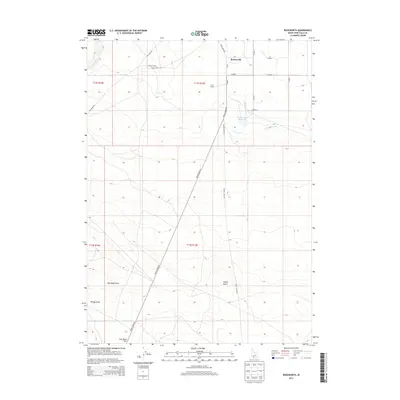
2013 Map of Roseworth
USGS Topo · Published 2013About this map
The high desert landscape of Twin Falls County is defined by its agricultural infrastructure and isolated homesteads in this 2013 survey. The small settlement of Roseworth sits at the intersection of House Creek Rd and E 2550 N, serving as a central point for the surrounding ranchlands. Named properties like the Conover Ranch and Clark Ranch highlight the importance of family-owned operations in this region of Idaho. The management of water is evident through the presence of the Cedar Mesa Reservoir, which feeds into the Cedar Mesa Canal and the Clark Lateral to sustain local ranching.
Find a feature on this map
25 named features on this map. Tap any name to fly to it.
Don’t see what you’re looking for? This feature index may not catch every label — zoom into the map to look around manually.
Map Details
Editions of this 2013 Roseworth Map
This is the sole edition of this map. No revisions or reprints were ever made.
Other maps of this area

1955 · Twin Falls
USGS Topo · 1:250,000

1958 · Twin Falls
USGS Topo · 1:250,000

1964 · Roseworth
USGS Topo · 1:24,000

1965 · Roseworth SE
USGS Topo · 1:24,000

1965 · Roseworth NE
USGS Topo · 1:24,000

1965 · Tuanna Butte
USGS Topo · 1:24,000

1977 · Cedar Creek Reservoir
USGS Topo · 1:24,000

1978 · Browns Bench North
USGS Topo · 1:24,000

1979 · Coonskin Butte NE
USGS Topo · 1:24,000
1979 · Roseworth NE
USGS Topo · 1:24,000