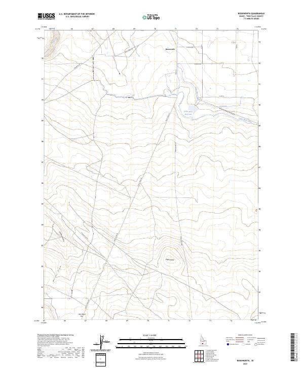
2023 Map of Roseworth
USGS Topo · Published 2023About this map
Roseworth stands as a focal point in this southern Idaho landscape, where high-desert terrain meets a complex network of twentieth-century irrigation. The movement of water is the primary architect of human activity here, evidenced by the Cedar Mesa Reservoir and its associated distribution channels, including the Cedar Mesa Canal, Clark Lateral, and A Lateral. These man-made features contrast with the natural drainage patterns of Devil Creek and Worley Draw, illustrating the effort required to support agriculture in Twin Falls County.
Find a feature on this map
26 named features on this map. Tap any name to fly to it.
Don’t see what you’re looking for? This feature index may not catch every label — zoom into the map to look around manually.
Map Details
Editions of this 2023 Roseworth Map
This is the sole edition of this map. No revisions or reprints were ever made.
Other maps of this area

1955 · Twin Falls
USGS Topo · 1:250,000

1958 · Twin Falls
USGS Topo · 1:250,000

1964 · Roseworth
USGS Topo · 1:24,000

1965 · Roseworth SE
USGS Topo · 1:24,000

1965 · Roseworth NE
USGS Topo · 1:24,000

1965 · Tuanna Butte
USGS Topo · 1:24,000

1977 · Cedar Creek Reservoir
USGS Topo · 1:24,000

1978 · Browns Bench North
USGS Topo · 1:24,000

1979 · Coonskin Butte NE
USGS Topo · 1:24,000
1979 · Roseworth NE
USGS Topo · 1:24,000