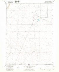
1979 Map of Roseworth
USGS Topo · Published 1980About this map
Agricultural development and ranching operations define this high desert landscape south of the Snake River. The small community of Roseworth sits at the northern edge of the sheet, supported by a network of irrigation infrastructure including the Cedar Mesa Canal, Antelope Canal, and the Cedar Mesa Reservoir. These waterworks stand in contrast to the more arid southern reaches, where the land transitions into the draws and flats of the high plateau.
Find a feature on this map
22 named features on this map. Tap any name to fly to it.
Don’t see what you’re looking for? This feature index may not catch every label — zoom into the map to look around manually.
Map Details
Editions of this 1979 Roseworth Map
This is the sole edition of this map. No revisions or reprints were ever made.
Other maps of this area

1955 · Twin Falls
USGS Topo · 1:250,000

1958 · Twin Falls
USGS Topo · 1:250,000

1964 · Roseworth
USGS Topo · 1:24,000

1965 · Roseworth SE
USGS Topo · 1:24,000

1965 · Roseworth NE
USGS Topo · 1:24,000

1965 · Tuanna Butte
USGS Topo · 1:24,000

1977 · Cedar Creek Reservoir
USGS Topo · 1:24,000

1978 · Browns Bench North
USGS Topo · 1:24,000

1979 · Coonskin Butte NE
USGS Topo · 1:24,000
1979 · Roseworth NE
USGS Topo · 1:24,000