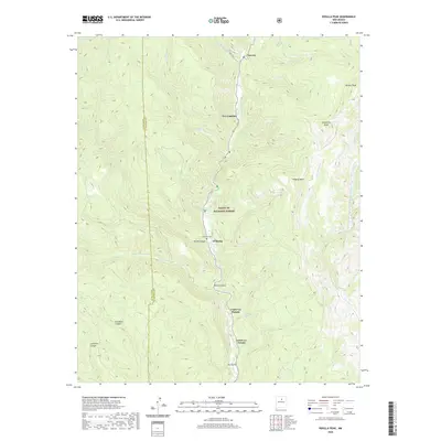
2020 Map of Rosilla Peak
USGS Topo · Published 2020About this map
The Pecos River carves a deep path through the canyon lands of the Santa Fe National Forest in this 2020 topographic survey. This corridor of the Pecos Wild and Scenic River serves as the primary axis for small settlements like Tererro and Tres Lagunas, where the valley floor provides the only level ground for habitation. Steep terrain rises sharply from the riverbanks toward high points like Rosilla Peak and the expansive Viveash Mesa.
Find a feature on this map
32 named features on this map. Tap any name to fly to it.
Don’t see what you’re looking for? This feature index may not catch every label — zoom into the map to look around manually.
Map Details
Editions of this 2020 Rosilla Peak Map
This is the sole edition of this map. No revisions or reprints were ever made.
Other maps of this area

1889 · Santa Fe
USGS Topo · 1:125,000

1894 · Santa Fe
USGS Topo · 1:125,000

1953 · Glorieta
USGS Topo · 1:24,000

1953 · Mc Clure Reservoir
USGS Topo · 1:24,000

1953 · Aspen Basin
USGS Topo · 1:24,000

1954 · Santa Fe
USGS Topo · 1:250,000

1958 · Santa Fe
USGS Topo · 1:250,000

1961 · Honey Boy Ranch
USGS Topo · 1:24,000

1961 · Rosilla Peak
USGS Topo · 1:24,000
1961 · Pecos
USGS Topo · 1:24,000