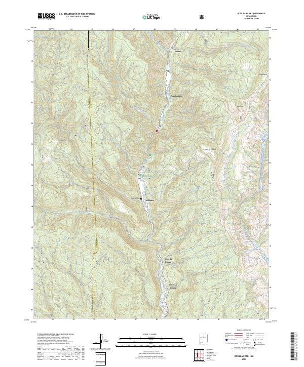
2023 Map of Rosilla Peak
USGS Topo · Published 2023About this map
The Pecos River carves a central corridor through this section of the Santa Fe National Forest, where a string of small settlements follows the water. From Tererro in the north through Tres Lagunas and El Macho, the valley floor supports life beneath the high elevations of Rosilla Peak and Viveash Mesa. The map provides specific detail for local researchers, including the El Macho Cem and the distinct neighborhoods of Upper La Posada and Lower La Posada. Deep canyons like Macho Canyon, Dalton Canyon, and Alamitos Canyon define the drainage patterns of the western slopes, while Holy Ghost Creek and Indian Creek feed into the main river channel. This geography illustrates a classic Southwestern pattern of montane settlement where human activity remains closely tied to the available riparian narrow and protected canyon bottoms.
Find a feature on this map
32 named features on this map. Tap any name to fly to it.
Don’t see what you’re looking for? This feature index may not catch every label — zoom into the map to look around manually.
Map Details
Editions of this 2023 Rosilla Peak Map
This is the sole edition of this map. No revisions or reprints were ever made.
Other maps of this area

1889 · Santa Fe
USGS Topo · 1:125,000

1894 · Santa Fe
USGS Topo · 1:125,000

1953 · Glorieta
USGS Topo · 1:24,000

1953 · Mc Clure Reservoir
USGS Topo · 1:24,000

1953 · Aspen Basin
USGS Topo · 1:24,000

1954 · Santa Fe
USGS Topo · 1:250,000

1958 · Santa Fe
USGS Topo · 1:250,000

1961 · Honey Boy Ranch
USGS Topo · 1:24,000

1961 · Rosilla Peak
USGS Topo · 1:24,000
1961 · Pecos
USGS Topo · 1:24,000