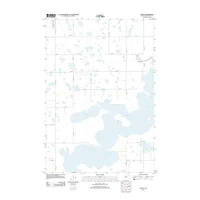
2012 Map of Roslyn
USGS Topo · Published 2012About this map
Glacial waters dominate the landscape of Day County in this early 21st-century study, centered on the town of Roslyn. The vast expanses of Waubay Lake and South Waubay Lake illustrate the prairie pothole region's complex hydrology, where shorelines shift and merge with the surrounding agricultural grid. To the north, Roslyn Cem serves as a primary point of interest for genealogists, while the town's residential core is defined by a grid including Main St, Krasinski Ave, and Kosciusko Ave. To the southeast, Minnewasta Lake sits near the junction of 137th St and 441st Ave. The map reflects a rural environment where section-line roads like 436th Ave and Co Rd-15 facilitate access through a terrain heavily influenced by its numerous wetlands and small, unnamed sloughs.
Find a feature on this map
24 named features on this map. Tap any name to fly to it.
Don’t see what you’re looking for? This feature index may not catch every label — zoom into the map to look around manually.
Map Details
Editions of this 2012 Roslyn Map
This is the sole edition of this map. No revisions or reprints were ever made.
Other maps of this area

1953 · Milbank
USGS Topo · 1:250,000

1958 · Milbank
USGS Topo · 1:250,000

1970 · Eden
USGS Topo · 1:24,000

1970 · Waubay
USGS Topo · 1:24,000

1970 · Piyas Lake
USGS Topo · 1:24,000

1970 · Britton 4 SE
USGS Topo · 1:24,000

1970 · Waubay SW
USGS Topo · 1:24,000

1970 · Roslyn
USGS Topo · 1:24,000

1970 · Enemy Swim Lake West
USGS Topo · 1:24,000

1973 · Webster
USGS Topo · 1:24,000