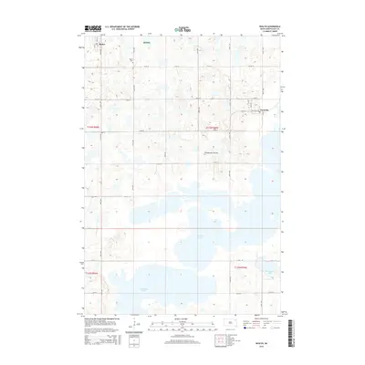
2015 Map of Roslyn
USGS Topo · Published 2015About this map
Roslyn sits at the northern edge of this high prairie landscape, a small community defined by its proximity to the glacial waters of the Coteau des Prairies. The topography is dominated by an intricate network of wetlands and larger bodies of water, most notably Waubay Lake and S Waubay Lake which cover much of the southern half of the quadrangle. For those tracing family histories in Day County, the map provides precise locations for the Roslyn Cem and the neighboring town of Grenville to the east. The grid of section lines and gravel roads, such as 131st St and 138th St, provides a framework for the agricultural lands that weave between protected areas like the Dcwpa. The eastern shore of Minnewasta Lake marks the edge of a distinct lake district that has long shaped the settlement patterns and recreation of this South Dakota region.
Find a feature on this map
24 named features on this map. Tap any name to fly to it.
Don’t see what you’re looking for? This feature index may not catch every label — zoom into the map to look around manually.
Map Details
Editions of this 2015 Roslyn Map
This is the sole edition of this map. No revisions or reprints were ever made.
Other maps of this area

1953 · Milbank
USGS Topo · 1:250,000

1958 · Milbank
USGS Topo · 1:250,000

1970 · Eden
USGS Topo · 1:24,000

1970 · Waubay
USGS Topo · 1:24,000

1970 · Piyas Lake
USGS Topo · 1:24,000

1970 · Britton 4 SE
USGS Topo · 1:24,000

1970 · Waubay SW
USGS Topo · 1:24,000

1970 · Roslyn
USGS Topo · 1:24,000

1970 · Enemy Swim Lake West
USGS Topo · 1:24,000

1973 · Webster
USGS Topo · 1:24,000