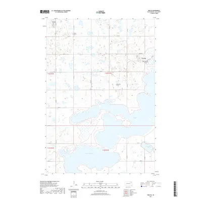
2017 Map of Roslyn
USGS Topo · Published 2017About this map
Roslyn and Grenville serve as the primary hubs in this lake-dominated landscape of Day County. Situated atop the glacial highlands of the Coteau des Prairies, the area is defined by a complex network of glacial depressions and massive water bodies, most notably Waubay Lake, South Waubay Lake, and Minnewasta Lake. This 2017 survey reveals a rural settlement pattern where section-line roads, such as Co Rd 66 and Co Rd 6, negotiate the irregular shorelines and wetland basins. For those tracing local heritage, the map identifies significant land-use markers including the Roslyn Lutheran Cem north of town and Saint Joseph Catholic Cem on the outskirts of Grenville, providing fixed points for genealogical research in this northern prairie environment.
Find a feature on this map
30 named features on this map. Tap any name to fly to it.
Don’t see what you’re looking for? This feature index may not catch every label — zoom into the map to look around manually.
Map Details
Editions of this 2017 Roslyn Map
This is the sole edition of this map. No revisions or reprints were ever made.
Other maps of this area

1953 · Milbank
USGS Topo · 1:250,000

1958 · Milbank
USGS Topo · 1:250,000

1970 · Eden
USGS Topo · 1:24,000

1970 · Waubay
USGS Topo · 1:24,000

1970 · Piyas Lake
USGS Topo · 1:24,000

1970 · Britton 4 SE
USGS Topo · 1:24,000

1970 · Waubay SW
USGS Topo · 1:24,000

1970 · Roslyn
USGS Topo · 1:24,000

1970 · Enemy Swim Lake West
USGS Topo · 1:24,000

1973 · Webster
USGS Topo · 1:24,000