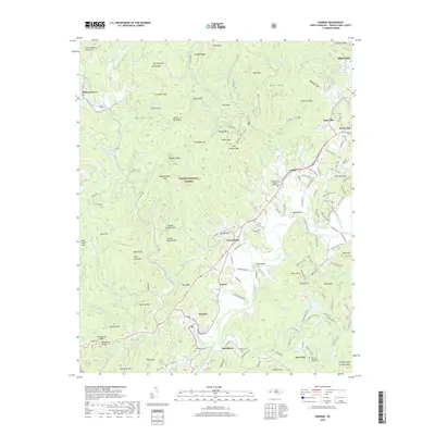
2019 Map of Rosman
USGS Topo · Published 2019About this map
Rosman and the upper reaches of the French Broad River system anchor this detailed topographic view of Transylvania County. This region is characterized by the complex drainage of the North Fork, West Fork, and Middle Fork, which converge near Calvert and the town of Rosman. High peaks of the Great Balsam Mountains and the Pisgah National Forest rise to the west, including Quebec Mtn and Piney Mtn, creating a dramatic transition from the river valleys to the high ridges of Brushy Mtn and Stone Mtn.
Find a feature on this map
177 named features on this map. Tap any name to fly to it.
Don’t see what you’re looking for? This feature index may not catch every label — zoom into the map to look around manually.
Map Details
Editions of this 2019 Rosman Map
This is the sole edition of this map. No revisions or reprints were ever made.
Other maps of this area

1905 · Pisgah
USGS Topo · 1:125,000

1906 · Pisgah
USGS Topo · 1:125,000

1935 · Brevard
USGS Topo · 1:24,000

1935 · Eastatoe Gap
USGS Topo · 1:24,000

1935 · Sam Knob
USGS Topo · 1:24,000

1935 · Rosman
USGS Topo · 1:24,000

1935 · Lake Toxaway
USGS Topo · 1:24,000

1935 · Reid
USGS Topo · 1:24,000

1935 · Table Rock
USGS Topo · 1:24,000

1935 · Shining Rock
USGS Topo · 1:24,000