2022 Map of Rosman
USGS Topo · Published 2022About this map
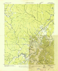
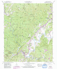
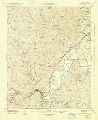
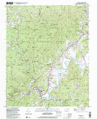
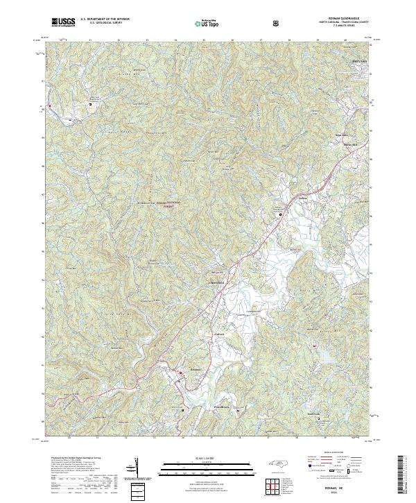
The French Broad River winds through the heart of this Transylvania County landscape, anchoring a series of small valley settlements including Rosman, Cherryfield, and Calvert. The terrain is defined by the high ridges of the Pisgah National Forest and the Great Balsam Mountains, where numerous gaps like Cycleham Gap and Low Notch Gap once dictated the movement of early travelers. For those researching local families, the map identifies several significant burial grounds and congregations, such as the Shoal Creek Baptist Church Graveyard and the East Fork Methodist Church Cem. North of Brevard, the Brevard Music Center Lake and Mitchums Lake mark a more developed corridor, while the western reaches remain a network of steep knobs and named coves, including the prominent Daves Rock and the Three Forks Mtn area.
Find a feature on this map
170 named features on this map. Tap any name to fly to it.
Don’t see what you’re looking for? This feature index may not catch every label — zoom into the map to look around manually.
Map Details
Editions of this 2022 Rosman Map
This is the sole edition of this map. No revisions or reprints were ever made.
Historical Maps of Illahee Hills Through Time
5 maps found