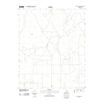
2010 Map of Ross Canyon
USGS Topo · Published 2010About this map
McMurtry Ranch sits near the center of this Briscoe County landscape, where the flat plains of the Texas Panhandle begin to break into the drainage systems of the Red River. The terrain is defined by the sharp descent into Ross Canyon, a prominent geological feature that cuts through the otherwise level high plains. This 2010 survey by the U. S. Geological Survey illustrates the transition from tableland to break-land, where seasonal waterways like Tule Creek and Coon Creek carve winding paths through the caprock. The area is interlaced with a grid of rural routes such as Co Rd 12 and Co Rd 16, reflecting a late-twentieth-century infrastructure designed for large-scale ranching and land management. The presence of Ranch Rd 3365 provides a primary corridor through this ranching territory, connecting isolated homesteads to the broader region.
Find a feature on this map
15 named features on this map. Tap any name to fly to it.
Don’t see what you’re looking for? This feature index may not catch every label — zoom into the map to look around manually.
Map Details
Editions of this 2010 Ross Canyon Map
This is the sole edition of this map. No revisions or reprints were ever made.
Other maps of this area

1954 · Plainview
USGS Topo · 1:250,000

1958 · Plainview
USGS Topo · 1:250,000

1960 · Indian Peak
USGS Topo · 1:62,500

1965 · Ross Canyon
USGS Topo · 1:24,000

1965 · Big Betty Reservoir
USGS Topo · 1:24,000

1965 · Silverton
USGS Topo · 1:24,000

1965 · Rock Creek
USGS Topo · 1:24,000

1965 · Vigo Park
USGS Topo · 1:24,000

1965 · Cope Creek
USGS Topo · 1:24,000

1967 · Hay Lake
USGS Topo · 1:24,000