
1965 Map of Ross Canyon
USGS Topo · Published 1967About this map
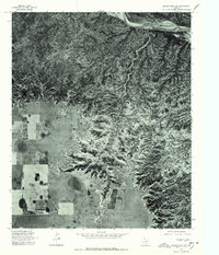
Ross Canyon cuts deeply into the High Plains of the Texas Panhandle, creating a sharp transition between the rugged breaklands and the level plateau in Briscoe County. The landscape is defined by the contrast between the winding drainage of Ross Canyon to the north and the expansive agricultural plains to the south, where numerous Well and wells dot the gridded terrain. Settlement is sparse, anchored primarily by the McMurtry Ranch which sits at the edge of the canyon breaks. Evidence of the mid-century infrastructure required to maintain these isolated ranching and farming operations is present through landmarks like the Radio Tower and various unimproved trails that traverse the caprock edge. This survey documents the intersection of natural erosion and human utility in a region defined by its groundwater and livestock history.
Find a feature on this map
7 named features on this map. Tap any name to fly to it.
Don’t see what you’re looking for? This feature index may not catch every label — zoom into the map to look around manually.
Map Details
Editions of this 1965 Ross Canyon Map
This is the sole edition of this map. No revisions or reprints were ever made.
Other maps of this area

1954 · Plainview
USGS Topo · 1:250,000

1958 · Plainview
USGS Topo · 1:250,000

1960 · Indian Peak
USGS Topo · 1:62,500

1965 · Big Betty Reservoir
USGS Topo · 1:24,000

1965 · Silverton
USGS Topo · 1:24,000

1965 · Rock Creek
USGS Topo · 1:24,000

1965 · Vigo Park
USGS Topo · 1:24,000

1965 · Cope Creek
USGS Topo · 1:24,000

1967 · Hay Lake
USGS Topo · 1:24,000
1976 · Indian Peak SW
USGS Topo · 1:24,000