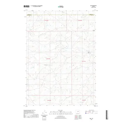
2018 Map of Ross
USGS Topo · Published 2018About this map
Wind Cr and its tributaries define this pocket of the Wyoming high plains near the Converse and Campbell county line. The drainage network, including N Fork Wind Cr and S Fork Wind Cr, creates a landscape of etched draws and prongs that have dictated the placement of local routes like Ross Rd. Named features such as Ross Avery Draw and Finley Draw offer specific points of interest for those researching land use and ranching history in this arid environment. The map shows the Public Land Survey System grid reaching toward Antelope Cr in the south, reflecting the organized division of the Western range into townships like T40N R75W. This 2018 survey documents the persistent rural character of the area, where the terrain is marked by seasonal watercourses like Fink Prong and Red Rock Draw.
Find a feature on this map
17 named features on this map. Tap any name to fly to it.
Don’t see what you’re looking for? This feature index may not catch every label — zoom into the map to look around manually.
Map Details
Editions of this 2018 Ross Map
This is the sole edition of this map. No revisions or reprints were ever made.
Other maps of this area

1954 · Artesian Draw
USGS Topo · 1:24,000

1954 · Pine Tree
USGS Topo · 1:24,000

1954 · Taylor Ranch
USGS Topo · 1:24,000

1955 · Newcastle
USGS Topo · 1:250,000

1955 · Arminto
USGS Topo · 1:250,000

1958 · Arminto
USGS Topo · 1:250,000

1958 · Newcastle
USGS Topo · 1:250,000

1959 · Edgerton
USGS Topo · 1:62,500

1960 · Ross
USGS Topo · 1:62,500

1962 · Arminto
USGS Topo · 1:250,000