
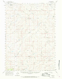
1960 Map of Ross
USGS Topo · Published 1962About this map
The Bozeman Trail cuts across this high plains landscape of Converse and Campbell Counties, a corridor of western migration marked here by the Bozeman Trail Monument. This 1960 survey illustrates a ranching economy defined by vast distances and family-named homesteads such as Spearhead Ranch, Barton Ranch, and Allemand Ranch. The settlement at Ross sits near the North Fork Wind Creek, serving as a central point in a region of dry draws and seasonal watercourses.
Find a feature on this map
31 named features on this map. Tap any name to fly to it.
Don’t see what you’re looking for? This feature index may not catch every label — zoom into the map to look around manually.
Map Details
Editions of this 1960 Ross Map
2 editions found
Other maps of this area

1954 · Artesian Draw
USGS Topo · 1:24,000

1954 · Pine Tree
USGS Topo · 1:24,000

1954 · Taylor Ranch
USGS Topo · 1:24,000

1955 · Newcastle
USGS Topo · 1:250,000

1955 · Arminto
USGS Topo · 1:250,000

1958 · Arminto
USGS Topo · 1:250,000

1958 · Newcastle
USGS Topo · 1:250,000

1959 · Fifty-Five Ranch
USGS Topo · 1:62,500

1959 · Edgerton
USGS Topo · 1:62,500

1959 · Ormsby Draw
USGS Topo · 1:62,500