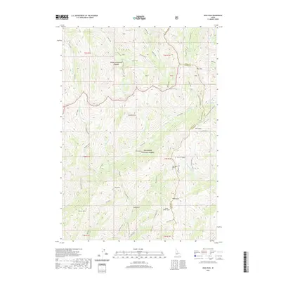
2020 Map of Ross Peak
USGS Topo · Published 2020About this map
Ross Peak stands as the dominant summit in this high-altitude landscape situated along the boundary of Boise National Forest and Sawtooth National Forest. The map illustrates a complex drainage system where the headwaters of numerous creeks, such as Senator Creek and Trail Creek, carve deep into the Idaho backcountry. The terrain is defined by its verticality, with Gunsight Peak providing a second major landmark in a region punctuated by alpine features like Bass Lakes and Goat Lake.
Find a feature on this map
61 named features on this map. Tap any name to fly to it.
Don’t see what you’re looking for? This feature index may not catch every label — zoom into the map to look around manually.
Map Details
Editions of this 2020 Ross Peak Map
This is the sole edition of this map. No revisions or reprints were ever made.
Other maps of this area

1894 · Rocky Bar
USGS Topo · 1:125,000

1900 · Sawtooth
USGS Topo · 1:125,000

1955 · Hailey
USGS Topo · 1:250,000

1959 · Hailey
USGS Topo · 1:250,000

1962 · Hailey
USGS Topo · 1:250,000

1964 · Ross Peak
USGS Topo · 1:24,000

1964 · Cayuse Point
USGS Topo · 1:24,000
1964 · Jumbo Mtn
USGS Topo · 1:24,000
1964 · Grouse Butte
USGS Topo · 1:24,000

1964 · Marshall Peak
USGS Topo · 1:24,000