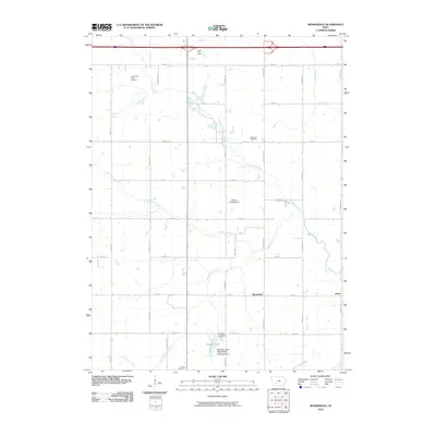
2010 Map of Rosserdale
USGS Topo · Published 2010About this map
Middle River winds through this central Iowa landscape, defining the agricultural character of the region near the settlement of Rosserdale. The survey captures a network of rural section roads, such as Orange Ave and 170th St, which connect dispersed homesteads and local landmarks. To the north, the 5 x 80 Golf Course and Abandoned Timber Cemetery sit near the river's path, while further south, the Meadow Lake State Public Hunting Area surrounds Meadow Lake and the Meadow Lake Dam.
Find a feature on this map
30 named features on this map. Tap any name to fly to it.
Don’t see what you’re looking for? This feature index may not catch every label — zoom into the map to look around manually.
Map Details
Editions of this 2010 Rosserdale Map
This is the sole edition of this map. No revisions or reprints were ever made.
Other maps of this area

1952 · Panora
USGS Topo · 1:62,500

1954 · Greenfield
USGS Topo · 1:62,500

1954 · Omaha
USGS Topo · 1:250,000

1957 · Omaha
USGS Topo · 1:250,000

1958 · Omaha
USGS Topo · 1:250,000

1971 · Fontanelle
USGS Topo · 1:24,000

1971 · Canby
USGS Topo · 1:24,000

1971 · Casey
USGS Topo · 1:24,000
1982 · Stuart North
USGS Topo · 1:24,000
1982 · Menlo
USGS Topo · 1:24,000