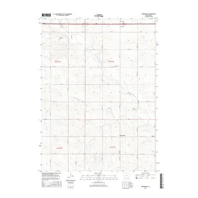
2015 Map of Rosserdale
USGS Topo · Published 2015About this map
Middle River and its numerous tributaries, including N Turkey Cr and S Turkey Cr, carve through this section of Adair County, Iowa. The landscape is defined by the rural settlements of Rosserdale and Howe, which sit along the township lines of T77N and T76N. This modern survey details a well-preserved grid of section roads like Co RD g27 and Co RD g15 that connect isolated local landmarks. For genealogists and local historians, the map is particularly valuable for identifying several country burial grounds, including the Abandoned Timber Cem, Jefferson Cem, and Loucks Grove Cem. These sites, along with Meadow Lake, provide a clear picture of the longstanding rural infrastructure and family-named landmarks that have persisted in this corner of Iowa through the early 21st century.
Find a feature on this map
34 named features on this map. Tap any name to fly to it.
Don’t see what you’re looking for? This feature index may not catch every label — zoom into the map to look around manually.
Map Details
Editions of this 2015 Rosserdale Map
This is the sole edition of this map. No revisions or reprints were ever made.
Other maps of this area

1952 · Panora
USGS Topo · 1:62,500

1954 · Greenfield
USGS Topo · 1:62,500

1954 · Omaha
USGS Topo · 1:250,000

1957 · Omaha
USGS Topo · 1:250,000

1958 · Omaha
USGS Topo · 1:250,000

1971 · Fontanelle
USGS Topo · 1:24,000

1971 · Canby
USGS Topo · 1:24,000

1971 · Casey
USGS Topo · 1:24,000
1982 · Stuart North
USGS Topo · 1:24,000
1982 · Menlo
USGS Topo · 1:24,000