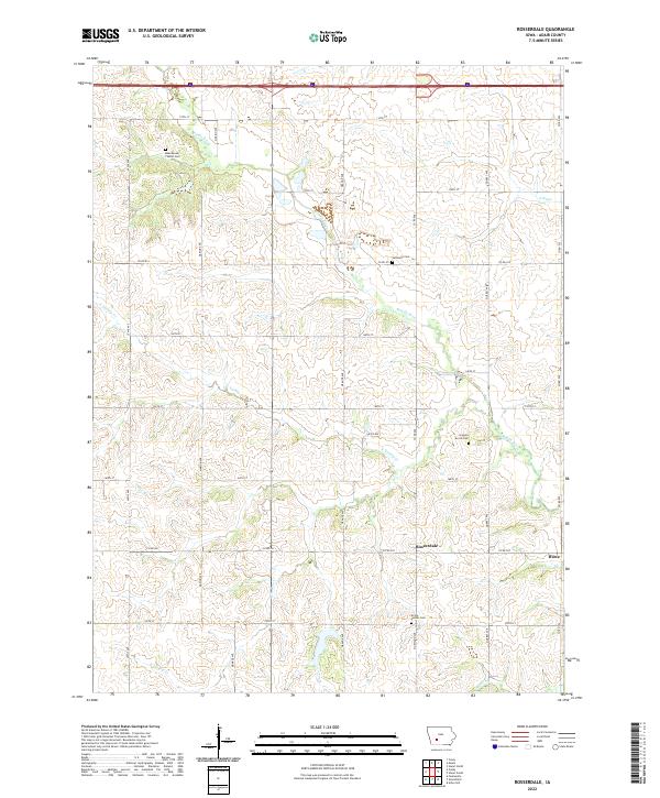
2022 Map of Rosserdale
USGS Topo · Published 2022About this map
Rosserdale and Howe anchor this rural Adair County landscape, where the headwaters of several critical Iowa waterways carve through the agricultural tableland. The drainage of the Middle River dominates the northern half of the quadrangle, while the southern reaches are defined by the forks of N Turkey Cr and S Turkey Cr. This 2022 survey reveals a land still heavily shaped by early settlement patterns and family heritage, preserved in the distribution of its burial grounds. Researchers will find several distinct sites, including the Abandoned Timber Cem, Jefferson Cem, and the Loucks Grove Cem. The grid of county roads, such as Co RD g15 and Co RD g27, dictates the modern movement across a terrain that has changed little in its fundamental rural character over the decades.
Find a feature on this map
33 named features on this map. Tap any name to fly to it.
Don’t see what you’re looking for? This feature index may not catch every label — zoom into the map to look around manually.
Map Details
Editions of this 2022 Rosserdale Map
This is the sole edition of this map. No revisions or reprints were ever made.
Other maps of this area

1952 · Panora
USGS Topo · 1:62,500

1954 · Greenfield
USGS Topo · 1:62,500

1954 · Omaha
USGS Topo · 1:250,000

1957 · Omaha
USGS Topo · 1:250,000

1958 · Omaha
USGS Topo · 1:250,000

1971 · Fontanelle
USGS Topo · 1:24,000

1971 · Canby
USGS Topo · 1:24,000

1971 · Casey
USGS Topo · 1:24,000
1982 · Stuart North
USGS Topo · 1:24,000
1982 · Menlo
USGS Topo · 1:24,000