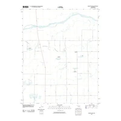
2010 Map of Rosston NW
USGS Topo · Published 2010About this map
The Cimarron River winds across this northern Oklahoma landscape, where the agricultural footprint is defined by a grid of rural roads and water management features. Evidence of historic land use appears in the Old Settlers Irrigation Ditch, a system that cuts through the terrain to support farming in this prairie environment. The area's reliance on water infrastructure is further illustrated by several impoundments, including Casey 1 Reservoir and several reservoirs identified by state numbering, such as Oknoname 05901 Reservoir. These features, managed by structures like the Casey 1 Dam, show a modified drainage system where local tributaries like Stink Creek and Redoubt Creek feed into the larger river basin. Modern transportation is represented by US Route 283, which provides a north-south corridor through the section-line road network.
Find a feature on this map
30 named features on this map. Tap any name to fly to it.
Don’t see what you’re looking for? This feature index may not catch every label — zoom into the map to look around manually.
Map Details
Editions of this 2010 Rosston NW Map
This is the sole edition of this map. No revisions or reprints were ever made.
Other maps of this area

1892 · Meade
USGS Topo · 1:125,000

1896 · Ashland
USGS Topo · 1:125,000

1954 · Perryton
USGS Topo · 1:250,000

1955 · Woodward
USGS Topo · 1:250,000

1955 · Pratt
USGS Topo · 1:250,000

1955 · Dodge City
USGS Topo · 1:250,000

1958 · Perryton
USGS Topo · 1:250,000

1958 · Woodward
USGS Topo · 1:250,000

1958 · Dodge City
USGS Topo · 1:250,000

1959 · Pratt
USGS Topo · 1:250,000