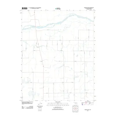
2012 Map of Rosston NW
USGS Topo · Published 2012About this map
Cimarron River dominates the northern reaches of this Harper County landscape, its broad, braided channels cutting through a terrain defined by agricultural development and water management. Evidence of early cooperative water projects is seen in the Old Settlers Irrigation Ditch, which traverses the central plains south of the river. This infrastructure reflects the region's historic reliance on local waterways for survival and industry. The map captures a high-plains grid of section lines and rural routes, such as E0030 Rd and N1740 Rd, that organize the open space between intermittent water sources like Stink Cr and Redoubt Cr. Further south, the Casey 1 Reservoir stands as a more modern modification of the drainage patterns, illustrating how water is captured and stored in this arid Oklahoma landscape.
Find a feature on this map
24 named features on this map. Tap any name to fly to it.
Don’t see what you’re looking for? This feature index may not catch every label — zoom into the map to look around manually.
Map Details
Editions of this 2012 Rosston NW Map
This is the sole edition of this map. No revisions or reprints were ever made.
Other maps of this area

1892 · Meade
USGS Topo · 1:125,000

1896 · Ashland
USGS Topo · 1:125,000

1954 · Perryton
USGS Topo · 1:250,000

1955 · Woodward
USGS Topo · 1:250,000

1955 · Pratt
USGS Topo · 1:250,000

1955 · Dodge City
USGS Topo · 1:250,000

1958 · Perryton
USGS Topo · 1:250,000

1958 · Woodward
USGS Topo · 1:250,000

1958 · Dodge City
USGS Topo · 1:250,000

1959 · Pratt
USGS Topo · 1:250,000